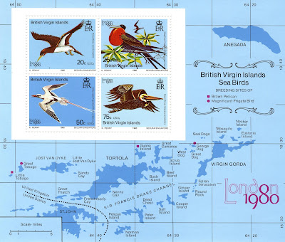
BRITISH VIRGIN ISLANDS.
World Philatelic Exhibition. "London 1980". Sea Birds.
Map of the British part of the Virgin rchipielago.
Minisheet issued on 06.05.1980.
20 + 25 + 50 + 75 cents of United States dollar.
Printing: Offset litography.
Size: 152 x 130 mm.
Catalogs
- Michel No. BL13.
- Scott No. 388a.
- StampWorld No. 387-390.
- Stanley Gibbons No. MS443.
- Yvert et Tellier No. BF 14.
The British Virgin Islands, officially the Virgin Islands, are a British Overseas Territory in the Caribbean, to the east of Puerto Rico and the U.S. Virgin Islands and north-west of Anguilla. The islands are geographically part of the Virgin Islands archipelago and are located in the Leeward Islands of the Lesser Antilles and part of the West Indies. The British Virgin Islands consist of the main islands of Tortola, Virgin Gorda, Anegada, and Jost Van Dyke, along with more than 50 other smaller islands and cays. About 16 of the islands are inhabited. The capital, Road Town, is on Tortola, the largest island. The total area of the territory is 153 km2 (59 sq mi).

No comments:
Post a Comment