Showing posts with label - Mountains. Show all posts

27/11/2022

MONACO


MONACO.

Definitive stamps.
Monte Carlo Port.
Stamp issued in 1943.
Face value: 15 Monegasque francs.
Design: Jean Antonin Delzers (1873-1943).
Engraving: Tournay.
Printing: Recess.
Print: 589,230 copies.
Size: 41 x 26 mm.

Catalogs
- Michel No. 243.
- Scott No. 174B.
- StampWorld No. 243.
- Stanley Gibbons No. 268.
- Unificato No. 262.
- Yvert et Tellier No. 262.

The old port of Monte Carlo or Port de Fontvieille, also known by the historical name of Port Hercule, is located in a small natural bay to the south of the Rock of Monaco. Between the mid-20th century and the beginning of the 21st century, it was expanded with land reclaimed from the sea and equipped with a semi-floating concrete breakwater.

25/11/2022

KUWAIT


KUWAIT / الكويت

Definitive stamps.
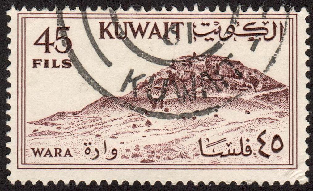
Wara Hill.
Third stamp in a set of 9, issued on 01.04.1961.
Face value: 40 Kuwaiti fils.
Printing: Recess.

Catalogs
- Michel No. 156.
- Scott No. 166.
- StampWorld No. 156.
- Stanley Gibbons No. 157.
- Yvert et Tellier No. 154.

The Wara or Tell Wārah Hill (Arabic: جبل وارة) is located south of the city of Kuwait City and northwest of al-Ahmadi, in the east of the country, to whose governorate it belongs. It has a height of 30.5 m (100 ft) above sea level. Its coordinates are 28.991384 N 47.952419 E. Archaeologists found prehistoric remains at the site.

22/11/2022

FAROE ISLANDS


FAROE ISLANDS / FØROYAR.

Eysturoy Island.
Leirvík.
Third stamp in a set of 3, issued on 13.02.2006.
Face value: 20 Faroese króna.
Design: J. A. Arge.
Printed by Österreichische Staatsdruckerei, Wien.
Printing: Offset lithography.
Size: 35 x 35 mm.

Catalogs
- AFA No. 551.
- Michel No. 559.
- Scott No. 469.
- StampWorld No. 541.
- Stanley Gibbons No. 508.
- Yvert et Tellier No. 555.

Leirvík is a town on the east coast of Eysturoy Island, on the shores of the Leirvíksfjørður strait. It was an important regional ferry harbor until April 2006, when the 6.2 km (3.85 mi) long Nordoy tunnel to Klaksvík was opened. In 2022, the town had a population of 1,048. Archaeological excavations show that Leirvík was settled by the Vikings in the 9th century. The local economy is based on a shipyard and, above all, on fishing. Also visible on the stamp is the 612 m (2,008 ft) Sigatindur mountain.

19/11/2022

HONG KONG


HONG KONG / 香港

Port Past and Present
Victoria from the port (ca. 1855).
First stamp in a set of 4, issued on 12.01.1982.
Face value: 20 Hong Kong cents.
Printing: Offset lithography.
Size: 44 x 28 mm.

Catalogs
- Michel No. 380.
- Scott No. 380.
- StampWorld No. 384.
- Stanley Gibbons No. 407.
- Yvert et Tellier No. 374.

The Port of Hong Kong (Chinese: 香港港口), located by the South China Sea, is a deepwater seaport dominated by trade in containerized manufactured products, and to a lesser extent raw materials and passengers. It is one of the busiest ports in the world, in all categories of shipping movements, cargo handled and passengers carried. In 1841, after the arrival of a British Royal Navy ship, the colonization of Hong Kong began, and ten years later the port received the name of Victoria, in honor of the queen. In 1997 the United Kingdom ceded sovereignty of Hong Kong to the People's Republic of China.

14/11/2022

UNITED STATES


UNITED STATES.

Nevada First Settlement Centennial.
Carson Valley arount 1850.
Stamp issued on 14.07.1951.
Face value: 3 cents of United States dollar.
Printing: Recess.
Print: 112,000,000 copies.

Catalogs
- Michel No. 617.
- Scott No. 999.
- StampWorld No. 808.
- Stanley Gibbons No. 996.
- Yvert et Tellier No. 550.

Currently, Carson Valley is included in the Nevada Micropolitan Statistical Area, within Douglas County. In 1851, the town of Genoa, situated within the Carson River Valley, approximately 68 km (42 mi) south of Reno, was the first permanent settlement in Nevada by Mormon traders selling goods to settlers on their way to California. The settlement originated as a trading post called Mormon Station. In 1856, Orson Hyde changed the name of the community to Genoa, after the Italian city. Genoa served as the first capital of the Nevada Territory in 1861, until it was moved that year to Carson City. Nevada's first newspaper, the Territorial Enterprise, was founded in Genoa in 1858, but moved to Virginia City in 1860. Douglas County is located in western Nevada and extends from Carson Valley to the Sierra Nevada.

07/11/2022

IRAN


IRAN / ایران

Definitive stamps.
Farahnaz Dam and 
Mohammad Reza Shah Pahlavi.
Third stamp in a set of 11, issued on 01.09.1974.
Face value: 50 Iranian dinar.
Printing: Photogravure.

Catalogs
- Michel No. 1740.
- Scott No. 1822.
- StampWorld No. 1741.
- Stanley Gibbons No. 1898.
- Yvert et Tellier No. 1611.

Farahnaz Dam, now know as Latiyan Dam (Persian: سد لتيان), built for the Tehran Regional Water Board between 1963 and 1967, is a concrete max gravity structure located in a maximum height of 107 m (351 ft) and a crest length of nearly 360 m (1,181 ft). It is located 25 km (15.5 mi) north-est of Tehran, in the south of city of Lavasan, in the course of the Jajrud River, southern part of central Alborz mountain range. Associated with the dam are a hydro-electric peak power station.

05/11/2022

AUSTRIA


AUSTRIA / ÖSTERREICH.

Scenic Beauties in Austria.
Weißsee (Salzburg).
Stamp issued on 09.05.2000.
Face value: 7 Austrian schilling.
Design: Peter Sinawehl (b. 1948).
Engraving: Gerhart Schmirl (b. 1942).
Printing: Photogravure and recess.
Print: 2,800,000 copies.
Size: 43 x 36 mm.

Catalogs
- AFA No. 2203.
- ANK No. 2345.
- Michel No. 2310.
- Scott No. 1813.
- StampWorld No. 2359.
- Stanley Gibbons No. 2557.
- Unificato No. 2143.
- Yvert et Tellier No. 2136.

The Weißsee (also spelled Weisssee) is a reservoir in the state of Salzburg. It is located in the Stubache catchment area, on the border of the Granatspitz and Glockner groups, in the Alps, in the municipality of Uttendorf, at 2,250 m (7,382 ft) above sea level. Its function is to store water and its storage volume is 15.7 million m³ (554 ft3). In 1929 the Enzingerboden and Tauernmoossee power stations were established on the site, and in 1941 the Schneiderau power station. Between 1950 and 1952, the Weißsee was enlarged by the construction of a 39 m (128 ft) high gravity dam with a 235 m (771 ft) long straight crown. In 1951 the area was opened to tourism thanks to the installation of a cable car and ski slopes began to be built. The Rudolfshütte mountain hotel on the northeast side of the lake, opened in 1958 on the site of the Austrian Alpine Club until 1952, is also visible on the stamp.

04/11/2022

BULGARIA


BULGARIA / БЪЛГАРИЯ.

Landscapes.
Vrattsata (Вратцата) or Vratsa Pass.
First stamp in a set of 6, issued on 26.10.1964.
Face value: 1 Bulgarian stotinka.
Printing: Photogravure.
Print: 10,000,000 copies.
Size: 22 x 33 mm.

Catalogs
- Michel No. 1470.
- Scott No. 1372.
- StampWorld No. 1482.
- Stanley Gibbons No. 1481.
- Yvert et Tellier No. 1285.

The Vrattsata Pass is a narrow passage amidst the tall cliffs formed by the Leva River, in the Vrachanski Balkan, which is part of the Balkan Mountains. It is located between the towns of Vratsa (393 m, or 1,289 ft, above sea level) and Zgorigrad (465 m, or 1,525 ft), in northwestern Bulgaria. In the Middle Ages, it was called Vratitsa and remains of the fortress of the same name (10th - 12th centuries) are preserved in it. The sheer cliffs of Vrattsata are the highest on the Balkan Peninsula (over 400 m, or 1,312 ft) and are the most popular climbing spot in Bulgaria. The third category road III-1002 runs through the pass. It was declared a natural monument in 1964, with an area of 2 hectares, and is part of the Vrachanski Balkan Nature Park.

03/11/2022

ISRAEL


ISRAEL / יִשְׂרָאֵל‎ - إِسْرَائِيل

Israel Landscapes.
Coral Island (Pharaoh's Island).
Stamp issued on 23.04.1975.
Face value: 2.00 Israeli lira.
Printing: Photogravure.
Size: 31 x 26 mm.

Catalogs
- AFA No. 
- Michel No. 526yI.
- Scott No. 473ii.
- StampWorld No. 535.
- Stanley Gibbons No. 509p.
- Yvert et Tellier No. 470a.

Coral Island (sometimes called Pharaoh's Island) is a rocky islet that now belongs to Egypt, about 250 m ( 820 ft) to the east to the coast of the Sinai Peninsula in the Gulf of Eilat (or Aqaba), at the northern end of the Red Sea, and 13 km (8.1 mi) southwest of modern Eilat (Israel). It is made of solid granite. Some scholars identify this island port with the biblical Ezion-Geber. A wall of casemates with towers surrounding the island at the height of the coast, including the port, has not yet been able to be dated, and the ruins of a castle probably correspond to an Ayyubid fortification of the 12th and 13th centuries.

30/10/2022

BELGIAN CONGO


BELGIAN CONGO / CONGO BELGE - BELGISCH-CONGO.

Country Symbols (definitive stamps).
Port of Matadi.
First stamp in a set of 8, issued on 01.10.1915.
Face value: 5 Belgian centimes.
Engraved and printed by Waterlow & Sons, London.
Printing: Recess.
Print: 225,000 copies.
Size: 39 x 25 mm.

Catalogs
- Michel No. 25.
- Scott No. 60.
- StampWorld No. 55.
- Stanley Gibbons No. 70.
- Yvert et Tellier No. 64.

The Port of Matadi is situated on the left bank of the Congo River, 148 km (92 mi) from the mouth, very close to the border with Angola. It was founded by Henry Morton Stanley in 1879. The construction of the Matadi–Kinshasa Railway (built between 1890 and 1898) made it possible to transport goods from deeper within Congo's interior to the port of Matadi, stimulating the city to become an important trading center. The word Matadi means ‘stone’ in the local Kikongo language. The town is built on steep hills.

Thanks to Dragan Buškulić for his contribution (https://worldofstamp2.wordpress.com/).

27/10/2022

MADAGASCAR


MADAGASCAR / REPOBLIKA MALAGASY.

Transportation.
President Tsiranana Bridge.
Second stamp in a set of 2, issued on 04.01.1962.
Face value: 25 French African CFA francs.
Design and engraving: GilbertAufschneider (b. 1927).
Printing: Recess.
Size: 41 x 27 mm.

Catalogs
- Michel No. 474.
- Scott No. 324.
- StampWorld No. 523.
- Stanley Gibbons No. R-36.
- Yvert et Tellier No. 361.

The President Tsiranana Bridge over the Sofia River is located between the towns of Antsohihy and Boriziny, in the Sofia region of northwestern Madagascar. The RN6 national road runs through it. It has now lost its original name, which was that of the first president of the country after its independence from France, Philibert Tsiranana, who remained in power until October 1972. [No further information on this bridge could be obtained.]

23/10/2022

NORTH KOREA


NORTH KOREA / 북조선 - 북한 - 北朝

Mountain landscapes.
Waterfall on Mount Myohyang.
Third stamp in a set of 4, issued 09.09.1973.
Face value: 10 North Korean chon.
Printing: Offset lithography.

Catalogs
- Michel No. 1191.
- Scott No. 1138.
- StampWorld No. 1218.
- Stanley Gibbons No. 1167.
- Yvert et Tellier No. 1110.

The Mount Myohyang (Hangul: 묘향산 ["Mysterious Fragrant Mountain"]), 1,909 m (6,263 ft) high, is named after the mystic shapes and fragrances found in the area. It is a sacred site as, according to legend, it was the home of King Dangun, forefather of the Korean people. Much of the mountain is covered by mixed broadleaf and coniferous forest and protected in a 16,000 hectares (62 sq mi) national park. Some 7,000 hectares (27 sq mi) have been identified by BirdLife International as an Important Bird Area (IBA). In 2009 UNESCO designated this mountain a world biosphere reserve, citing its cultural significance as well as the spectacular cliffs providing habitat for 30 endemic plant species, 16 plant species that are globally threatened and 12 endangered animal species.

16/10/2022

ICELAND


ICELAND / ÍSLAND.

EUROPA C.E.P.T. issues.
Skaftafell National Park.
First stamp in a set of 2, issued on 05.05.1986.
Face value: 10 Icelandic króna.
Printing: Photogravure.
Print: 1,000,000 copies.
Size: 36 x 26 mm.

Catalogs
- AFA No. 647.
- Michel No. 648.
- Scott No. 622.
- StampWorld No. 649.
- Stanley Gibbons No. 677.
- Yvert et Tellier No. 601.

Skaftafell National Park, founded on September 15, 1967, and enlarged twice afterwards, was situated between Kirkjubæjarklaustur and Höfn in the south of Iceland. On 7 June 2008, it became a part of the larger Vatnajökull National Park. Before its inclusion into the new park, it measured about 4,807 km2 (2,884 mi2), making it Iceland's second largest national park. It contains the valley Morsárdalur, the mountain Kristínartindar and the glacier Skaftafellsjökull (a spur of the Vatnajökull ice cap). The scenery around Skaftafell is full of stark contrasts. The various glacial tongues are flanked by jagged mountains, with the glacier-topped peak of Hvannadalshnjúkur rising highest.

10/10/2022

JAPAN


JAPAN / 
日本.

National Parks. 
Mount Hotaka, in Chūbu-Sangaku National Park.
First stamp in a set of 2, issued on 10.08.1972.
Face value: 10 Japanese yen.
Printing: Photogravure.
Print: 32,000,000 copies.
Size: 36 x 26 mm.

Catalogs 
- Michel No. 1157.
- Sakura No. P137.
- Scott No. 1120.
- StampWorld No. 1147.
- Stanley Gibbons No. 1298.
- Yvert et Tellier No. 1061.

Mount Hotaka or Hotakadake (Japanese: 穂高岳) is one of the 100 Famous Japanese Mountains as coined by the median, reaching a height of 3,190 m (10,466 ft). It is situated within Chūbu-Sangaku National Park, in Hida Mountains (Northern Alps) between Toyama and Gifu prefectures.

Thanks to Krystyna Betiuk for his contribution (https://pocztowkowezbiory.blogspot.com/)

27/09/2022

ISRAEL


ISRAEL / יִשְׂרָאֵל‎ - إِسْرَائِيل

Modern ports.
Port of Elat.
First stamp in a set of 3, issued on 19.02.1969.
Face value: 0.30 Israeli lira.
Printing: Photogravure.
Print: 1,648,000 copies.
Size: 61 x 26 mm.

Catalogs
- Israel Philatelic Federation No. 449.
- Michel No. 433.
- Scott No. 378.
- StampWorld No. 432.
- Stanley Gibbons No. 405.
- Yvert et Tellier No. 371.

Elat or Eilat (Hebrew: אֵילַת; Arabic: إِيلَات) is Israel's southernmost city, with a population of 52,299 in 2019, a busy port and popular resort at the northern tip of the Red Sea, on what is known in Israel as the Gulf of Eilat and in Jordan as the Gulf of Aqaba. The name Elat was given to Umm al-Rashrash (أم الرشراش) in 1949 by the Committee for the Designation of Place-Names in the Negev. The name refers to Elath, a location mentioned in the Hebrew Bible that is thought to be located across the border in modern Jordan. During the British Mandate era, a British police post existed in the area, which was known as Umm Al-Rashrash. The area was designated as part of the Jewish state in the 1947 UN Partition Plan. During the 1948 Arab-Israeli War, the abandoned police post was seized without a fight on March 10, 1949, as part of Operation Uvda. This marked the end of Israel's war for independence. Eilat's airport was built in 1949 and the port opened in 1955. Elat began to develop rapidly after the Suez Crisis in 1956, when the tourist industry began to flourish in the city. In the stamp you can also see the Elat Mountains (Hebrew: הרי אילת Harei Eilat), with a maximum elevation of 899 m (2,949 ft).

25/09/2022

GUERNSEY


GUERNSEY / GUERNESEY - GERNÉSI.

Bailiwick Views.
Petit Bot Beach.
First stamp in a set of 2, issued on 28.03.1988.
Face value: 12 Guernsey penny.
Printing: Offset lithography.
Size: 26.3 x 34.3 mm.

Catalogs
- AFA No. 408.
- Michel No. 413A.
- Scott No. 372.
- StampWorld No. 408.
- Stanley Gibbons No. 306b.
- Unificato No. 417.
- Yvert et Tellier No. 417.

Petit Bot Bay, with its beach, sits at the base of two wooded valleys in a sheltered section of Guernsey's south coast. The Martello Tower is seen on the stamp, one of the two towers that have survived of the fifteen that were built on the coast of the island between 1778 and 1779 to deter possible French attacks after France declared itself an ally of the Americans in the American Revolutionary War. The tower, open to the public, features a small interpretive exhibit. These towers were designed to accommodate muskets only (i. e. there was no provision for artillery), and their manning was the responsibility of the Royal Guernsey Militia.

-
Thanks to Dragan Buškulić for his contribution (https://worldofstamp2.wordpress.com/).

22/09/2022

ALBANIA


ALBANIA / SHQIPERIA.

Tourism.
Maja e Thatë Peak.
Fifth stamp in a set of 6, issued in 3.1965.
Face value: 5 Albanian lek.
Printing: Offset lithography.
Print: 80,000 copies.

Catalogs
- Michel No. 930.
- Scott No. 805.
- StampWorld No. 939.
- Stanley Gibbons No. 891.
- Yvert et Tellier No. 756.

Maja e Thatë is a 2,406-metre-high (7,894 ft) mountain peak. It lies within the massif of Kolata, in the eastern part of the Albanian Alps, within Valbonë Valley National Park, roughly 2 km (1 mi) northwest of Valbonë, n the municipality of Tropojë, Kukës county (near Montenegro’s border), and rises more than 1,500 m (4,921 ft) above the village. The mountain's southern and western lower slopes are relatively rich in beech and pine forests, while the higher slopes consist of very steep dolomite and limestone rock walls, suitable for mountaineering and rock climbing.

21/09/2022

ITALY


ITALY / ITALIA.

Tourism.
Stromboli.
Third stamp in a set of 4, issued on 01.06.1985.
Face value: 450 Italian lire.
Design: E. Golyahovsk.
Printed by I.P.Z.S. (Istituto Poligrafico e Zecca dello Stato), Roma.
Printing: Photogravure.
Print: 5,000,000 copies.
Size: 48 x 40 mm.

Catalogs
- Michel No. 1924.
- Sassone No. 1718.
- Scott No. 1632.
- StampWorld No. 1900.
- Stanley Gibbons No. 1879.
- Unificato No. 1727.
- Yvert et Tellier No. 1656.

Stromboli is an island in the Tyrrhenian Sea, off the north coast of Sicily, containing Mount Stromboli (926 m or 3,038 ft hight), one of the four active volcanoes in Italy. It is one of the eight Aeolian Islands. The island's area is 12.19 square kilometers (4.7 sq mi), and its population was about 500 as of 2016, managed by the Municipality of Lipari. The volcano has erupted many times and is constantly active with minor eruptions, often visible from many points on the island and from the surrounding sea, giving rise to the island's nickname "Lighthouse of the Mediterranean". Its name is derived from the Ancient Greek name, Στρογγύλη (Strongýlē) which was derived from στρογγύλος (strongýlos, "round"), after the volcano's round, conical appearance when seen from a distance. The geological history of the island of Stromboli begins about 200,000 years ago.

20/09/2022

UNITED ARAB EMIRATES


UNITED ARAB EMIRATES / ٱلْإِمَارَاتُ ٱلْعَرَبِيَّةُ ٱلْمُتَّحِدَةُ

Definitive stamps. 
Khor Fakkan
 (Sharjah).
Last stamp in a set of 6, issued on 01.01.1973.
Face value: 75 UAE fils.
Printing: Offset lithography.
Size: 49 x 33 mm.

Catalogs
- Michel No. 6.
- Scott No. 18.
- StampWorld No. 6
- Stanley Gibbons No. 6.
- Yvert et Tellier No. 6.

Khor Fakkan (Arabic: خَوْر فَكَّان) is a city and exclave of the Emirate of Sharjah, located on the east coast of the United Arab Emirates, facing the Gulf of Oman, between the Shumayliyah Mountains and the Arabian Sea, and geographically surrounded by the Emirate of Fujairah. It is located in a bay, and is the only natural deep-water port in the region and one of the major container ports in the UAE, opened in 1979. The place has a long history of human settlement, and there have been found archaeological remains dating from the third to the first millennium BC. The city was captured by the Portuguese in the 16th century and was known as Corfacão. It was part of a series of fortified cities that Portugal had to control access to the Persian Gulf and the Gulf of Oman. In 1623 the Persian army tried to conquer the city, but was expelled by the Portuguese. However, in 1737, after the Portuguese had been driven out of Arabia, the Persians re-invaded Khor Fakkan with the help of the Dutch. In 1765, the city already belonged to a sheikh of Al Qasimi, the ruling family of Sharjah. Currently, the city has about 40,000 inhabitants.

16/09/2022

BRAZIL


BRAZIL / BRASIL.

Tourism.
Dedo de Deus, Rio de Janeiro, and location map.
Second stamp in a set of 2, issued on 06.07.1991.
Face value: 350 Brazilian cruzeiros.
Design: Lúcia TV Ramos & Álvaro A. Martins.
Printed by Casa da Moeda do Brasil.
Printing: Offset lithography.
Print: 2,125,000 copies.
Size: 44 x 26 mm.

Catalogs
- Michel No. 2423.
- Scott No. 2323.
- StampWorld No. 2445.
- Stanley Gibbons No. 2488.
- Yvert et Tellier No. 2028.

The Dedo de Deus (“Finger of God”) is a peak at 1,692 m (5,551 ft) in altitude whose outline resembles a hand pointing the index finger to the sky. It is one of several geological monuments of the Serra dos Órgãos National Park, which is located in the Serra do Mar, near the city of Teresópolis, in Rio de Janeiro Metropolitan Region. The first to step on the summit were José Guimarães Teixeira, Raul Carneiro and the Américo brothers, Alexandre and Acácio de Oliveira, on April 9, 1912.

-
Thanks to Dragan Buškulić for his contribution (https://worldofstamp2.wordpress.com/).