30/04/2021

TANZANIA


TANZANIA.

Famous East Africa Mountains.
Mount Kilimanjaro.
Minisheet issued on 24.8.2006.
Face value: 1000 + 1000 Tanzanian shilingi.
Printing: Offset lithography.
Size: 130 x 100 mm.

Catalogs
- Michel No. BL595.
- Scott No. 2434.
- StampWorld No. 4439-4440.
- Stanley Gibbons No. MS 2552a.

Mount Kilimanjaro is a dormant volcano in northeastern Tanzania, near the Kenyan border. It has three volcanic cones: Shira, 4,005 m (13,140 ft); Mawenzi, 5,149 m (16,893 ft); and Kibo, with Uhuru Peak, 5,895 m (19,341 ft) at the rim of its crater. It is the highest mountain in Africa. It is integrated into the Kilimanjaro National Park and is drained by a network of streams and by the Lumi and Pangani rivers. Kilimanjaro is a major climbing destination: after numerous failed attempts by various climbers, Hans Meyer and Ludwig Purtscheller, with African guides and porters, were the first Europeans to reach the top on October 6, 1889.

-
Thanks to Kumar Biswas for his contribution (https://kumar-omnibus.blogspot.com/).

PANAMA


PANAMA / PANAMÁ.

Airmail definitive stamps.
Map of Panama.
Stamp issued on 04.08.1949.
Face value: 5 cents of Panamanian balboa.
Printing: Recess.
Size: 29 x 25 mm,

Catalogs
- Michel No. 300.
- Scott No. C112.
- StampWorld No. 377.
- Stanley Gibbons No. 232.
- Yvert et Tellier No. PA 105.

In 1501, Rodrigo de Bastidas was the first European to reach the Isthmus of Panama. In 1502, on his fourth voyage, Columbus reached the Atlantic coast of the isthmus. In 1510, Vasco Núñez de Balboa founded Santa María la Antigua del Darién, the first city in current Panamanian territory, called the Kingdom of Tierra Firme, and three years later he undertook the conquest of the interior of the isthmus: on September 23, 1513 he discovered the coast of the Pacific Ocean, which he called Mar del Sur (South Sea), which he took possession of in the name of the Crown of Castile. In 1751 Tierra Firme came under the jurisdiction of the Viceroyalty of New Granada. On November 28, 1821, Panama proclaimed its independence from the Crown of Spain and joined Gran Colombia. After several unsuccessful attempts, on November 3, 1903, it separated from Colombia and the independence of the Republic of Panama was proclaimed.

UKRAINE


UKRAINA / УКРАЇНА

Lviv Oblast.
Kamianets waterfall (Кам'янецький водоспад)
.
Stamp printed in a minisheet of 4, issued on 18.12.2019.
Face value: 8 Ukrainian hrivnia.
Design: 
Alexander Kalmykov.
Printing: Offset lithography.
Print: 30,000 copies.
Size: 33 x 27.5 mm.

Catalogs
- Michel No. 1854.
- StampWorld No. 1869.

The Kamianets or Kamianka waterfall (in Ukrainian: Кам'янецький водоспад) is located on the Kamianka River, within the Dubyna National Park, in the Ukrainian Carpathians, in the Lviv Oblast of western Ukraine. The height of the waterfall, which is divided into two parts by a rock, is 7 m (23 ft).

29/04/2021

GUERNSEY


GUERNSEY / GUERNESEY - GERNÉSI.

Bicentenary of Duke of Richmond's Survey of Guernsey.
Map of Guernsey Island by William Gardner in 1787.
Minisheet of 4 stamps issued on 10.02.1987.
Face value: 14, 29, 31 and 34 Guernsey penny.
Design: John Cooter.
Engraving: Questa.
Printing: Offset lithography.
Print: 176,655 copies.
Size: 124 x 103 mm.

Catalogs
- AFA No. A378-381.
- Michel No. BL4.
- Scott No. 347.
- StampWorld No. 
378-381.
- Stanley Gibbons No. MS393.
- Yvert et Tellier No. BF 7.

Duke of Richmond is a title in the Peerage of England that has been created four times in British history. It has been held by members of the royal Tudor and Stuart families. Charles Lennox, 3rd Duke of Richmond (1735-1806), was a British Army officer and politician.

The British cartographer William Gardner (1739-1800), commissioned by the Duke of Richmond, in 1787 made a survey of the Bailiwick of Guernsey for defense purposes, when the French were threatening to invade the Channel Islands. Gardner received 2 pence per acre that they surveyed, and they located every dwelling on the island. It was the first accurate map of the Bailiwick.

FRENCH TERRITORY OF THE AFARS AND THE ISSAS


FRENCH TERRITORY OF THE AFARS AND THE ISSAS /
TERRITOIRE FRANÇAIS DES AFARS ET DES ISSAS
 (now DJIBOUTI)

Assal Lake.
Airmail. First stamp in a set of 3, issued on 25.10.1974.
Face value: 49 French Somaliland francs.
Design: Pierrette Lambert (b. 1928).
Printing: Photogravure.

Catalogs
- Michel No. 108.
- Scott No. C99.
- StampWorld No. 108.
- Stanley Gibbons No. 618.
- Yvert et Tellier No. PA 102.

The French Territory of the Afars and the Issas (French: Territoire français des Afars et des Issas) was the name given to present-day Djibouti between 1967 and 1977, while it was still an overseas territory of France. The area was formerly known as French Somaliland (Côte française des Somalis). In 1958, on the eve of neighboring Somalia's independence in 1960, a referendum was held in the territory to decide whether or not to join the Somali Republic or to remain with France. The referendum turned out in favour of a continued association with France. On June 27, 1977, in another referéndum, a 99.8% of the electorate supported disengagement from France, officially marking Djibouti's independence.

Lake Assal (Arabic: بحيرة عسل) is a crater lake in west-central Djibouti, at the western end of the Gulf of Tadjoura, touching the Dikhil region, at the top of the Great Rift Valley, about 120 km (75 mi) west of Djibouti City. It is a saline lake that lies 155 m (509 ft) below sea level in the Afar Triangle, making it the lowest point on land in Africa. There is no output from the lake and, due to high evaporation, the salinity level of its waters is 10 times higher than that of the sea, making it the third most saline body of water in the world. Its area is 54 km2 (21 sq mi), its length is 19 km (12 mi) and its maximum width is 6.5 km (4 mi).

28/04/2021

TASMANIA


TASMANIA.

Landscapes.
Mount Wellington.
Second stamp in a set of 8, issued on 13.12.1899.
Face value: 1 Australian penny.
Printing: Recess.
Size: 28 x 36 mm.

Catalogs
- Michel No. 62.
- Scott No. 87.
- StampWorld No. 55.
- Stanley Gibbons No. 230.
- Yvert et Tellier No. 60.

Mount Wellington (in Palawa kani, Kunanyi) is a mountain in the southeastern coastal region of Tasmania. It is the summit of the Wellington Range, standing 1,271 m (4,170 ft) above sea level, and it is often covered in snow, sometimes even in summer. It is located within the Wellington Park preserve, just 22 km (14 miles) from the city of Hobart. No Europeans visited Tasmania until the late 18th century, when the French Marion du Fresne (1772) and the English Tobias Furneaux (1773) arrived in the south of the island (then known as Van Diemens Land). In 1793, Commodore John Hayes came to the Derwent River and named the mountain Skiddaw, although this name never gained popularity. In February 1836, Charles Darwin visited the city of Hobart and climbed Mount Wellington. In 1895 Clement Lindley Wragge installed the first weather station on the mountain.

-
Thanks to Dragan Buškulić for his contribution (https://worldofstamp2.wordpress.com/).

GUINEA


GUINEA / GUINÉE.

Landscapes.
Loos islands.
First stamp in a set of 6, issued on 20.06.1967.
Face value: 5 Guinean francs.
Printing: Photogravure.

Catalogs
- Michel No. 437,
- Scott No. 475.
- StampWorld No. 437.
- Stanley Gibbons No. 603.
- Yvert et Tellier No. 326,

The Loos or Los Islands are a small archipelago that lies off Conakry (Guinea's capital city) in the Atlantic Ocean, about 2 kilometers (1.2 miles) from the promontory that borders the southern side of Sangareya Bay. Its name is derived from the Portuguese Ilhas dos Ídolos. The area of the archipelago is 80 km2 (31 sq mi). There are three main islands: Fotoba (or Tamara), Kassa and Tayire (or Roume). Île de Corail, Île Blanche, Île Cabris, Île Poulet, Îlot Cabri, and Îlot de la Bouteille are smaller islands and islets located to the south. In Fotoba there is an old lighthouse; the island had a prison. Under British rule, Tayire was known as Crawford Island - said to have inspired Robert Louis Stevenson's novel Treasure Island. In 1755, Miles Barber of the Liverpool African Company established a trading post (then known as The Factory) on the island of Kassa.

DENMARK


DENMARK.

Norden issues. 
Troldkirken dolmen and small map of Denmark.
Second stamp in a set of 2, issued on 24.03.1983.
Face value: 3.50 Danish krone.
Design: Claus Achton Friis (1917-1999).
Engraving by Czesław Słania (1921-2005).
Printing: Recess.
Print: 9,300,000 copies.
Size: 31 x 24 mm.

Catalogs
- AFA No. 770.
- Michel No. 773.
- Scott No. 736.
- StampWorld No. 776.
- Stanley Gibbons No. 758.
- Yvert et Tellier No. 776.

Troldkirken is a Stone Age long barrow, situated near the village of Sønderholm, north of the Jutland Peninsula. The long barrow was constructed at some point during the Funnelbeaker culture 5–6,000 years ago and is marked out by forty-seven megaliths. Placed on the top of the barrow, is a polygonal chambered dolmen, with a large capstone. The whole monument is some 50 meters long. The name Troldkirken means both “Church of the Troll” and “Church of Sorcery” in Danish. There are several tumuli and dolmens in the area. The barrow is a protected site since 1809 and was one of the first pre-historic relics, to be protected by law in Denmark. Today The Historical Museum of Northern Jutland in Aalborg attends the barrow.

-
Thanks to Kazimierz R. Leszczyński for his contribution (http://leszkarozdub.blogspot.com).

27/04/2021

POLAND


POLAND / POLSKA.

Crown of Polish Mountains (Korona Gór Polski).
Minisheet issued on 30.06.2017.
Face value: 6 Polish złotych.
Design: Agnieszka Sancewicz.
Printing: Photogravure.
Print: 110,000 copies.
Size: 90 x 70 mm.

Catalogs
- Fischer No. BL395B. 
- Michel No. BL263A.
- StampWorld No. 4924.
- Unificato No. BF265A.
- Yvert et Tellier No. BF 255.

Crown of Polish Mountains (Polish: Korona Gór Polski) is a list of 28 peaks, one for each of the Polish mountain ranges. It was suggested by the geographer, traveler and writer Marek Więckowski and Dr. Wojciech Lewandowski in the tourism and local tradition magazine Poznaj swój kraj ('Know Your Country'). A list of 21 peaks was proposed on December 12, 1997 at a meeting called by the Poznaj swój kraj editors, and the Klub Zdobywców ("Club of the Conquerors") was created, with more than 21,000 members. As of 2009, the number of peaks increased to 28, the highest of which is the Rysy (2,499 m, 8,199 ft), in the Tatra Mountains, on the border with Slovakia.

-
Thanks to Sylvester Dulewski for his contribution (https://birdsposta.blogspot.com/).

FRANCE


FRANCE.

25th International Congress of Geography, Paris-Alps 1984.
Mountains.
Stamp issued on 25.08.1984.
Face value: 3 French francs.
Design: Jacques Jubert (b. 1940).
Printing: Recess.
Print: 6,000,000 copies.
Size: 80 x 26 mm.

Catalogs
- Michel No. 2458.
- Scott No. 1935.
- StampWorld No. 2450.
- Stanley Gibbons No. 2639.
- Yvert et Tellier No. 2327.

The 25th International Congress of Geography, convened by the French National Committee for Geography and the International Geographical Union, was held from August 27 to 31, 1984 at the Cité Internationale Universitaire de Paris, and was attended by 2,248 congressmen and more than 500 guests and visitors from 85 countries. After the congress, from 1 to 8 September, eight excursions were organized in which many of the participants toured the alpine space. The first International Congress of Geography was held in Antwerp, Belgium, in 1871.

VIETNAM


VIETNAM / VIỆT NAM.

Ha Long Bay (Vịnh Hạ Long).
First stamp in a set of 2, issued on 1959.
Face value: 150 Vietnamese 
đồng.
Printing: Photogravure.

Catalogs
- Michel No. 92.
- Scott No. 89.
- StampWorld No. 92 (North Vietnam).
- Stanley Gibbons No. N98.
- Yvert et Tellier No. 159 (North Vietnam).

Hạ Long Bay or Halong Bay (Vietnamese: Vịnh Hạ Long) is a UNESCO World Heritage Site in Quảng Ninh Province, in northeastern Vietnam. Administratively, the bay belongs to Hạ Long city, Cẩm Phả city, and is a part of Vân Đồn District. The bay features thousands of limestone karsts and isles in various shapes and sizes. It has an area of around 1,553 km2 (600 sq mi), including 1,960–2,000 islets, most of which are limestone. The core of the bay has an area of 334 km2 (129 sq mi) with a high density of 775 islets.

-
Thanks to Dragan Buškulić for his contribution (https://worldofstamp2.wordpress.com/).

26/04/2021

NEPAL


NEPAL / नेपाल.

Phewa Lake.
Second stamp in a set of 3. issued on 11.06.1970.
Face value: 25 Nepalese paisa.
Printing: Photogravure.

Catalogs
- Michel No. 250.
- Scott No. 235.
- StampWorld No. 246.
- Stanley Gibbons No. 251.
- Yvert et Tellier No. 220.

Phewa Tal or Fewa Lake (Nepali: फेवा ताल) is a freshwater lake in Nepal formerly called Baidam Tal located in the south of the Pokhara Valley, at an altitude of 742 m (2,434 ft) and covers an area of about 4.43 km2 (1.7 sq mi). It has an average depth of about 8.6 m (28 ft) and a maximum depth of 24 m (79 ft). It is stream-fed but a dam regulates the water reserves, therefore, the lake is classified as semi-natural freshwater lake. The lake is also famous for the reflection of mount Machhapuchhre and other mountain peaks of the Annapurna and Dhaulagiri ranges, in the Himalayas, on its surface.  

KIRIBATI


KIRIBATI.

Islands of Kiribati.
Map of Nikumaroro Island.
Second stamp in a set of 4, issued on 14.02.1984.
Face value: 30 cents of Kiribati dollar.
Printing: Offset lithography.

Catalogs
- Michel No. 436.
- Scott No. 437.
- StampWorld No. 115.
- Stanley Gibbons No. 216.
- Yvert et Tellier No. 115.

Republic of Kiribati (in Gilbertese, Ribaberiki Kiribati) is an independent island nation in the central Pacific Ocean. It comprises 32 atolls and one raised coral island, Banaba. Its total land area is 811 km2 (313 sq mi) and the islands are dispersed over 3.5 million km2 (1.4 million sq mi) on both sides of the equator. The permanent population is over 119,000 (2020). Kiribati gained its independence from the United Kingdom on July 12, 1979. The capital, South Tarawa, is the most populated area in the country and consists of several islets, connected by a long road. Kiribati is a member of the Pacific Community, the Commonwealth of Nations, the IMF and the World Bank, the Pacific Islands Forum, the Alliance of Small Island States, and a full member of the United Nations since 1999. Before its independence it was called the Gilbert Islands, in honor of Thomas Gilbert, who sighted some of the islands in 1788.

Nikumaroro, used to be known as Kemins Island or Gardner Island, it is a part of the Phoenix Islands, in the western Pacific Ocean. It is a remote, elongated, triangular coral atoll with profuse vegetation and a large central marine lagoon. It is about 7.5 km (4.7 mi) long by 2.5 km (1.6 mi) wide. The rim has two narrow entrances, both of which are blocked by a wide reef, which is dry at low tide. It is included among the 8 Kiribati atolls declared in 2006 Phoenix Islands Protected Area, expanded in 2008. The first record of a European sighting was made by the crew of the British whaling ship Eliza Ann in 1824. It is speculated that Amelia Earhart's plane, which in 1937 attempted her flight around the world with navigator Fred Noonan, may have crashed on this island, but no remains have been found to prove it.

25/04/2021

CROATIA


CROATIA / HRVATSKA.

Natural beauty of Croatia.
Kopački Rit Nature Park (Park prirode Kopački rit).
First stamp in a set of 3, issued on 28.01.2020.
No face issue (postage rate A = 3.10 Croatian kuna).
Design: 
Mario Romulić, Dražen Stojčić, Ivana Vučić, Tomislav-Jurica Kaćunić.
Printing: Offset lithography.
Print: 100,000 copies.
Size: 35.5 x 30 mm.

Catalogs
- Michel No. 1441.
- Scott No. 1157.
- StampWorld No. 1420.
- Yvert et Tellier No. 1325.

Kopački Rit Nature Park (Croatian: Park prirode Kopački rit), established in 1976, is located in eastern Croatia, in Osijek-Baranja County, northwest of the confluence of the Drava and the Danube rivers, is situated at the border with Serbia. It comprises many backwaters and ponds along the Danube. It is one of the most important, largest and most attractive preserved intact wetlands in Europe. Its área is 177 km2 (68 sq mi). A part of the park has been designated as a zoological reserve: there are around 260 bird species and around 40 fish species, and mammals as red deer, roe deer, wild boar, European wildcat, pine marten, stone marten, least weasel, and the Eurasian otter. It has also over 140 recorded species of plant.

-
Thanks to Dragan Buškulić for his contribution (https://worldofstamp2.wordpress.com/).

GERMANY


GERMANY / DEUTSCHLAND.

Saxon Switzerland National Park (Nationalpark Sächsische Schweiz).
Minisheet issued on 16.07.1998.
Face value: 1,10 + 2,20 German marks.
Printing: Offset lithography.
Print: 8,000,000 copies.
Size: 105 x 70 mm.

Catalogs
- AFA No. 2938/2939.
- Michel No. BL44.
- Scott No. 2009A.
- StampWorld No. 1873/1874.
- Stanley Gibbons No. MS 2860.
- Yvert et Tellier No. BF 43.

Saxon Switzerland National Park (German: Nationalpark Sächsische Schweiz), established in 1990, is located in the German Free State of Saxony, near the Saxon capital Dresden. It covers two separated areas of 93.5 km² (36.1 sq mi) in the heart of the German part of the Elbe Sandstone Mountains, which is often called Saxon Switzerland (German: Sächsische Schweiz). Saxon Switzerland is an intensively fissured and rocky canyon landscape. The highest peak of the National Park is at 556 m (1,814 ft) above sea level. The National Park adjoins Bohemian Switzerland National Park (Czech: České Švýcarsko) in the Czech Republic.

VATICAN CITY


VATICAN CITY / CIVITATIS VATICANÆ - CITTÀ DEL VATICANO.

39th International Eucharistic Congress. Bogota Colombia.
Simplified map of South America.
Last stamp in a set of 3, issued on 13.10.1968.
Facial value: 220 Italian lire.
Printed by I.P.F. (Istituto Poligrafico dello Stato), Roma.
Printing: Photogravure.
Print: 2,215,000 copies.
Size: 24 x 40 mm.

Catalogs
- Bolaffi No. 463.
- Michel No. 540.
- Sassone No. 463.
- Scott No. 463.
- StampWorld No. 539.
- Stanley Gibbons No. 515.
- Unificato No. 463.
- Yvert et Tellier No. 481.

The International Eucharistic Congress is an assembly of the Catholic Church, called by the Pope, which meets for a few days in a city determined by the Holy See, to worship the Eucharist and guide the mission of the Catholic Church in the world. It brings together bishops, priests, religious men and women, and lay faithful presided over by the Pope himself or by a delegate appointed by him. The first International Eucharistic Congress was held in the French city of Lille in 1881. The 39th Eucharistic Congress was held in Bogotá in August 1968, and Pope Paul VI traveled there to close it. At the same time the 2nd General Conference of the Latin American Episcopate was held in the city of Medellín.

DOMINICAN REPUBLIC


DOMINICAN REPUBLIC / REPÚBLICA DOMINICANA.

50th Anniversary of the first Dominican airmail stamp.
Map of the Greater Antilles.
Airmail stamp issued on 06.06.1978.
Face value: 10 cents of Dominican peso.
Printing: Offset lithography.

Catalogs
- Michel No. 1188.
- Scott No. C270.
- StampWorld No. 1198.
- Stanley Gibbons No. 1320.
- Yvert et Tellier No. PA 315.

Reproduction of the first airmail stamp issued by the Dominican Republic on May 31, 1928. The first postal flights from Santo Domingo went to Port-au-Prince (Haiti), Santiago de Cuba and San Juan of Puerto Rico.

24/04/2021

HONDURAS


HONDURAS.

Blanca Jeannette Kawas National Park.
Airmail Minisheet issued on 08.02.2013 (dated 2012).
Face value: 3 x 15 and 3 x 15 (= 120) Honduran lempiras.
Printing: Offset lithography.
Published by HONDUCOR, Empresa de Correos de Honduras.

Catalogs
- Michel No. BL102.
- Scott No. C1307.
- StampWorld No. 2034/2039.

Blanca Jeannette Kawas National Park (Spanish: Parque Nacional Blanca Jeannette Kawas) is located in the municipality of Tela, on the northern Caribbean coast of the Atlántida department of Honduras. The park covers an area of 781.62 km2 (301.79 sq mi) and has an maximal altitude of some 900 m (2,953 ft). It was established on November 4, 1994 as Punta Sal National Park. Its name was changed to Blanca Jeannette Kawas National Park in honor of Jeannette Kawas, an environmental activist who was murdered on February 6, 1995 for her work trying to keep the palm plantations out of the park. The park is made up of varied marine, terrestrial and wetlands ecosystems with a large number of species. These ecosystems include beaches, tropical forests, inundated forests, mangrove forests, lagoons and rivers.

-
Thanks to Dragan Buškulić for his contribution (https://worldofstamp2.wordpress.com/).

GERMAN DEMOCRATIC REPUBLIC


GERMAN DEMOCRATIC REPUBLIC / DEUTSCHE DEMOKRATISCHE REPUBLIK.

Hydrological structures.
Rappbode Dam (Rappbodetalsperre).
Last stamp in a set of 4, issued on 21.01.1986.
Face value: 70 GDR pfennig.
Printing: Photogravure and recess.
Print: 2,100,000 copies.
Size: 27.5 x 33 mm.

Catalogs
- Michel No. 2996.
- Scott No. 2519.
- StampWorld No. 2738.
- Stanley Gibbons No. E2706.
- Yvert et Tellier No. 2619.

The Rappbode Dam (German: Rappbodetalsperre) is the largest dam in the Harz region as well as the highest dam in Germany. It is located on the course of the river Rappbode. It was built between 1952 and 1959. Its height is 106 m (348 ft) and its length is 415 m (1,362 ft). The lake behind the dam acts primarily as a reserve drinking water reservoir for the towns east of the Harz. The reservoir also contributes to generation of hydro-electric power to a small extent.

-
Thanks to Kazimierz R. Leszczyński for his contribution (http://leszkarozdub.blogspot.com).

CHILE


CHILE.

International Geophysical Year 1957-1958.
Map of the Antarctic territory claimed by Chile.
Airmail. Second stamp in a set of 2, issued on 26.12.1958.
Face value: 50 Chilean pesos.
Printed by Casa de Moneda de Chile.
Printing: Recess.
Print: 3,000,000 copies.
Size: 30 x 33 mm.

Catalogs
- Michel No. 546,
- Scott No. C214.
- StampWorld No. 539.
- Stanley Gibbons No. 474.
- Yvert et Tellier No. PA 184.

On December 1, 1959, the twelve countries that had carried out scientific activities in and around Antarctica during the 1957-1958 International Geophysical Year signed the Antarctic Treaty in Washington. The Treaty entered into force on June 23, 1961, and has been accepted by many other nations. The Treaty recognizes, among other things, the interest of all humankind that Antarctica continue to be used exclusively for peaceful purposes and shall not become the scene or object of international discord. The signatory countries were: Argentina, Australia, Belgium, Chile, France, Japan, New Zealand, Norway, South Africa, the Soviet Union, the United Kingdom, and the United States.

The Chilean Antarctic Territory or Chilean Antarctica (Spanish: Territorio Chileno Antártico, Antártica Chilena) is the territory in Antarctica claimed by Chile. It ranges from 53° West to 90° West and from the South Pole to the 60° South parallel, partially overlapping the Argentine and British Antarctic claims. It is administered by the Cabo de Hornos municipality in the South American mainland. The territory claimed by Chile covers the South Shetland Islands, Antarctic Peninsula, called O'Higgins Land (Tierra de O'Higgins in Spanish) in Chile, and adjacent islands, the Alexander Island, Charcot Island, and part of the Ellsworth Land, among others. It has an area of 1,250,257.6 km2 (482,727.2 sq mi). Its boundaries are defined by a Decree issued on November 6, 1940, and published on June 21, 1955 by the Ministry of Foreign Affairs.

23/04/2021

SWITZERLAND


SWITZERLAND / SCHWEITZ - SUISSE - SVIZZERA - SVIZRA.

Pro Patria.
Lake Aegeri (Ägerisee).
Third stamp in a set of 5, issued on 01.06.1955.
Face value: 0.20 + 0.10 Swiss franc.
Printing: Photogavure.
Printed by Courvoisier-Attinger Arts Graphiques S.A., Biel/Bienne.
Print: 2,974,109 copies.

Catalogs
- Michel No. 615.
- Scott No. B244.
- StampWorld No. 609.
- Stanley Gibbons No. 564.
- Yvert et Tellier No. 564.
- Zumstein No. B73.

The Ägerisee (Lake Aegeri) is a 7.3 km² (2.8 sq mi) lake of glacial origin in the Schwyz Alps, at 724 m (2,375 ft) above sea level. Its length is 5.4 km (3.4 mi), its maximum width is 1.4 km (0.87 mi), and its mean depth is 49 m (161 ft). It belongs to the canton of Zug. Its main tributary is the Hüribach and empties through the Lorze. On its banks are the municipalities of Oberägeri and Unterägeri. Since 1992 it has been used as a drinking water reservoir.

SOVEREIGN MILITARY ORDER OF MALTA


SOVEREIGN MILITARY ORDER OF MALTA/
SOVRANO MILITARE ORDINE DI MALTA.

World Meeting of the Knights of the Order, October 1989.
Map of Malta
Second stamp in a set of 3, issued on 17.10.1989.
Face value: 3 SMOM scudi.
Printing: Offset lithography.
Printed by Printex Ltd., Qormi (Malta).
Print: 80,000.
Size: 60 x 40 mm.

Catalogs
- StampWorld No. 412.
- Unificato No. 314.

-
Thanks to Vairo Gregori for his contribution (https://ternifil.org/).

ICELAND


ICELAND / ÍSLAND.

International Year of Mountains.
Mount Snæfell.
Stamp issued on 07.03.2002.
No face value: 
postage for letters up to 20 g.
Printing: Offset lithography.
Print: 500,000 copies.
Size: 36 x 26 mm.

Catalogs
- AFA No. 989.
- Michel No. 1002.
- Scott No. 959.
- StampWorld No. 1003.
- Stanley Gibbons No. 1014.
- Yvert et Tellier No. 932.

Mount Snæfell is a 1,446 m (4,744 ft) high stratovolcano, located in western Iceland, at the end of the Snæfellsnes peninsula (Vesturland region), within the Snæfellsjökull National Park (in Icelandic, Þjóðgarðurinn Snæfellsjökull), on the shores of Faxaflói Bay, established in 2001. The top of the volcano is covered by the Snæfellsjökull glacier, visible on the stamp. Jules Verne, in his novel Journey to the Center of the Earth, places the entrance to the subsoil in the crater of this volcano (based on a manuscript by the 16th century Icelandic alchemist Arne Saknussemm).

PERU


 PERU / PERÚ.

Peruvian Exhibition in Paris.
Illustrated map of Peru.
Airmail. Last stamp in a set of 4, issued on 21.05.1958.
Face value: 2.50 Peruvian soles.
Printed by French Administration of Postal Services and Telecommunications (PTT), Paris.
Printing: Photogravure.
Print: 3,000,000 copies.
Size: 30 x 40 mm.

Catalogs
- Bustamante No. A143.
- Michel No. 571.
- Scott No. C157,
- StampWorld No. 561.
- Stanley Gibbons No. 818.
- Yvert et Tellier No. PA 141.

From May 20 to July 20, 1958, the exhibition "The Treasures of Peru" was held at the Petit Palais in Paris, an event organized to promote the history and culture of the country and at the same time, tourism and foreign investment. The sample consisted of almost 3,000 objects from private collections and Peruvian public entities: ceramic pieces, textiles and funerary objects from ancestral cultures, a collection of gold jewelery from the Inca empire, colonial furniture, paintings, photographs, typical dresses, sculptures, crafts, etc.

-
Thanks to Dragan Buškulić for his contribution (https://worldofstamp2.wordpress.com/).
22/04/2021

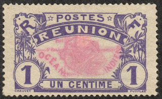
REUNION


REUNION / RÉUNION.

Definitive stamps.
Map of Reunion Island.
First stamp in a set of 6, issued in 1907.
Face value: 1 cent of French franc.
Printing: Typography.
Size: 41 x 25 mm.

Catalogs
- Michel No. 56.
- Scott No. 60.
- StampWorld No. 56.
- Stanley Gibbons No. 60.
- Yvert et Tellier No. 56.

Reunion (Reunion Creole: La Rényon) is an island of the Mascarene archipelago with the status of a French overseas department, located in the Indian Ocean, east of Madagascar, and constituted as an outermost region of the European Union. Like the rest of the overseas departments, it is also a region of France and is part of the Republic. Its area is 2,51km2 (970 sq mi) and its population (January 2021) was 858,450 inhabitants.
The island was occupied by the Arabs since the 10th century, but when the Portuguese arrived in 1513, they found it uninhabited and named it Santa Apolónia. In 1638 it was occupied by France, and it was administered from Mauritius. The island would not be officially claimed by France until 1642, and by decree of King Louis XIII it was renamed Île Bourbon. Colonization, however, did not begin until 1665, when the French East India Company (Compagnie française pour le commerce des Indes orientales) sent out the first settlers and African slaves. French immigration was completed with that from Africa, China, Malaysia and India, giving the population the diverse character it has today.

-
Thanks to Óscar Valencia for his contribution.

BELARUS


BELARUS / БЕЛАРУСЬ.

Struve Geodetic Arc.
Geodetic triangulations on a simplified map of Belarus.
Minisheet issued on 14.09.2017.
Face value: 3 Belarusian ruble.
Design: Yauheniya Biadonik.
Printing: Offset litography and hot stamping.
Print: 12,000 copies.
Size: 73 x 86 mm.

Catalogs
- AFA No. A1222.
- Belarus Post No. BL 126.
- Michel No. BL 153.
- StampWorld No. 1220.
- Yvert et Tellier No. BF 149.

The Struve Geodesic Arc is a chain of topographic triangulations that extends from the vicinity of Hammerfest, in northern Norway, to the Black Sea through ten countries and more than 2,820 km (1,752 mi). It was used to make the first precise measurement of a meridian. The chain was established and used by the German-Baltic scientist Friedrich Georg Wilhelm von Struve between the years 1816 to 1855 to establish the exact size and shape of the earth. The first point of the Arch is at the Tartu Observatory in Estonia, where Struve did much of the research on it. The triangulation chain measurement comprises 258 principal triangles and 265 geodetic vertices. In 2005, the chain was inscribed on the World Heritage List as a memorable ensemble made up of 34 commemorative plaques or obelisks built from the 265 points of the main station.

Friedrich Georg Wilhelm von Struve, born on April 15, 1793 and died on November 23, 1864, studied at the University of Dorpat (present-day Tartu, in Estonia, then in the Russian Empire) and did his research as an astronomer at the observatory of that city, of which he was director. In 1831 he published Beschreibung der Breitengradmessung in den Ostseeprovinzen Russlands ('Description of latitude measurement of the Baltic provinces of Russia').

-
Thanks to Kazimierz R. Leszczyński (http://leszkarozdub.blogspot.com) and Віктар Анішчык for your contribution.

21/04/2021

SWEDEN


SWEDEN / SVERIGE.

Mountain World.
Mount Tolpagorni.
Last stamp in a set of 4, issued on 27.03.1984.
Face value: 2,25 Swedish krona.
Design: T. Abrahamsson.
Engraving: Martin Mörck (b. 1955).
Printing: Recess.
Print: 18,800,000 copies.
Size: 27 x 32 mm.

Catalogs
- AFA No. 1269.
- Facit No. 1294.
- Michel No. 1275.
- Scott No. 1491.
- StampWorld No. 1277.
- Stanley Gibbons No. 1188.
- Yvert et Tellier No. 1259.

Mount Tolpagorni (Sami: Duolbagorni), at 1,662 m (5,453 ft), in the Kiruna Municipality, belongs to the Kebnekaise (Sami: Giebmegáisi or Giebnegáisi) massif, in Swedish Lapland, about 150 km (93 mi) north of the Arctic Circle and near the Norwegian border. At its top there is a depression in the rock, round like a cauldron, which resembles a volcanic crater; however, the mountain is not volcanic in origin.

TURKEY


TURKEY / TÜRKİYE (Ottoman Empire).

Definitive stamps.
Map of Dardanelles Strait.
Sixth stamp in a set of 8, issued on 11.10.1917.
Face value: 50 Ottoman para.
Printed: Typography.
(Printed in Vienna.)

Catalogs
- Michel No. 634.
- Scott No. 428.
- StampWorld No. 649.
- Stanley Gibbons No. 921.
- Yvert et Tellier No. 577.

The Dardanelles Strait (in Turkish, Çanakkale Boğazı), the Hellespont (Ἑλλήσποντος) of classical Greece, is a strait located in Turkey, between the Gallipoli peninsula (in Turkish, Gelibolu) and Anatolia. It connects the Aegean Sea with the Sea of Marmara. It measures 61 km (37.90 mi) in length, between 1.6 and 6.5 km (99.4 and 4 mi) wide, and has an average depth of about 50 m (164 ft). Historically, it has had a strategic role since ancient times. In 1915, during the First World War, the Battle of Gallipoli or the Dardanelles took place there, during which British, French, Australian and New Zealand troops tried, without success, to wrest control of the strait from the Ottoman Empire.

-
Thanks to Dragan Buškulić for his contribution (https://worldofstamp2.wordpress.com/).

NEW CALEDONIA


NEW CALEDONIA / NOUVELLE-CALÉDONIE - KANAKY
.

5th South Pacific Conference, Pago Pago.
Map of South Pacific Islands.
Stamp issued on 13.07.1962.
Face value: 15 CFP francs.
Design: Pierrette Lambert (b. 1928)
Engraving: Delrieu.
Printing: Photogravure.

Catalogs
- Michel No. 382.
- Scott No. 321.
- StampWorld No. 382.
- Stanley Gibbons No. 365.
- Yvert et Tellier No. 305.

The Fifth South Pacific Conference was held in Pago Pago, American Samoa, in July 1962. It was organized by the South Pacific Commission (?), founded in Nouméa (New Caledonia) in 1947. [Incomplete and not verified information. Sorry!]

20/04/2021

GREECE


GREECE / ЕΛΛΑΣ.

Landscapes.
The Samaria Gorge, Crete.
Ninth stamp in a set of 15, issued on 15.12.1979.
Face value: 10 Greek drachma.
Printing: Offset lithography.
Print: 26,000,000 copies.
Size: 26 x 37 mm.

Catalogs
- AFA No. 1413.
- Karamitsos No. 1511.
- Michel No. 1395.
- Scott No. 1336.
- StampWorld No. 1377.
- Stanley Gibbons No. 1498.
- Unificato No. 1373.
- Yvert et Tellier No. 1373.

The Samaria Gorge (Greek: Φαράγγι Σαμαριάς) is a National Park of Greece since 1962 on the island of Crete and a World's Biosphere Reserve. The gorge is in southwest Crete in the regional unit of Chania (Χανιά). It was created by a small river running between the White Mountains (Λευκά Όρη) and Mount Volakias (Βολακιας). The gorge is 16 km (9.94 mi) long, begins at an altitude of 1,250 m (4,101 ft) at the northern entrance and ends on the shores of the Libyan Sea at Agia Roumeli (Αγιά Ρουμέλη). The most famous part of the gorge (represented on the stamp) is the stretch known as the Gates (Πόρτες), where the sides of the gorge close to a width of only four meters and rise to a height of almost 300 m (980 ft).

FINLAND


FINLAND / SUOMI.

Reincorporation of the Porkkala area to Finland.
Map of Porkkala Peninsula and lighthouse.
Stamp issued on 26.01.1956.
Face value: 25 Finnish markka.
Design: Aarne Karjalainen (1898-1965).
Engraving: Birger Ekholm.
Printing: Recess.
Print: 1,996,519 copies.
Size: 24 x 34 mm.

Catalogs
- AFA No. 460.
- LaPe Finland No. 453.
- Michel No. 453.
- Scott No. 335.
- StampWorld No. 460.
- Stanley Gibbons No. 553.
- Yvert et Tellier No. 436.

Porkkala (Swedish: Porkala; Russian: Порккала) is a peninsula located in the Gulf of Finland, about 30 km (19 mi) from Helsinki. In the first half of the 20th century it had a great strategic value, since the coastal artillery located in it could cover more than half of the Gulf of Finland, attack the coast of the Estonian Soviet Socialist Republic, only 36 km (22.4 mi ) away, and block maritime connections between Leningrad (Saint Petersburg) and the Baltic Sea. At the end of World War II, the Soviet Union secured the right to maintain a naval base at Porkkala as established in the Moscow armistice that in 1944 ended the Continuation War. According to the armistice clauses, reiterated in the Paris Peace Treaties of 1947, the area would be ceded to the Soviets for 50 years. However, on September 19, 1955, a bilateral agreement was signed that put it under Finnish control as of January 26, 1956. The stamp commemorates this agreement.

EGYPT


EGYPT / مِصر

2nd Anniversary of the economic cooperation treaty with Sudan.
Simplified map of the course of the River Nile.
Stamp issued on 12.10.1984.
Face value: 3 Egyptian piastre.
Printing: Offset lithography.

Catalogs
- Michel No. 1488.
- Scott No. 1261.
- StampWorld No. 983.
- Stanley Gibbons No. 1557.
- Yvert et Tellier No. 1253.

The use of water from the Nile River has always produced disputes and has forced the establishment of agreements, sometimes covered by broader economic cooperation agreements. As early as 1959, three years after Sudan gained full independence, the two countries signed an agreement for the Full Utilization of Nile Waters, which was followed by a protocol for its implementation in 1960. In October 1982 Egypt and Sudan established an Economic Integration Charter with three institutions to handle the macanism to achieve the rather ambitious goal of total economic, social, political and military integration between the two countries. The parliament of the Nile Valley was the legislative Branch of the council.

AFGHANISTAN


AFGHANISTAN / افغانستان

Tourism promotion.
Flag and map of Afghanistan.
Third stamp in a set of 3, issued on 12.07.1964.
Face value: 3 afghani.
Printing: Photogravure.
Print: 300,000 copies.

Catalogs
- Michel No. 922.
- Scott No. 689.
- StampWorld No. 951.
- Stanley Gibbons No. 526.
- Yvert et Tellier No. 766.

Afghanistan is a multi-ethnic landlocked country in the interior of Asia. Its capital is Kabul. It shares borders with China, Pakistan, Iran, Turkmenistan, Uzbekistan and Tajikistan. There are no precise data on its total area, which would be, according to different sources, between 645,800 and 652,200 km² (249,345 and 251,815 sq mi). Its estimated population would also be, according to sources, between 28,200,000 and 33,610,000 inhabitants. Since the 1970s, the country has been embroiled in a series of military conflicts, the most extensive of which have been the Afghan-Soviet war (1979-1989) and the US invasion (2001-2014).

19/04/2021

FRANCE


FRANCE.

Lake and town of Gérardmer, Vosges.
Stamp issued on 15.04.2000.
Face value: 3 French francs / 0.46 euro.
Engraving: Claude Jumelet (b. Paris, 1946).
Printed by ITVF (Imprimerie des Timbres-poste et des Valeurs Fiduciaires), Boulazac.
Printing: Recess.
Print: 10,024,180 copies.
Size: 40 x 30 mm.

Catalogs
- AFA No. 3545.
- Michel No. 3452.
- Scott No. 2762.
- StampWorld No. 3430.
- Stanley Gibbons No. 3644.
- Yvert et Tellier No. 3311.

Gérardmer is a commune in the department of Vosges (Grand Est). Its population (2018 census) was 7,802 people. It is an important winter sports center. Its elliptical lake, located at an altitude of 660 m (2,165 ft) is of glacial origin, has an area of 1.15 km2 (0.44 sq mi), its maximum length is 2,020 m (6,627 ft) and its maximum width 750 m (2,460 ft). Its maximum depth is 38.40 m (126 ft). Fed by three streams, it empties into the Jamagne River.

ESTONIA


ESTONIA / EESTI.

Estonian lighthouses.
Juminda lighthouse in Juminda Peninsula (map).
Stamp issued on 08.03.2007.
Face value: 6 Estonian kroon / 0.38 euro.
Design: Roman Matkiewicz (b. Tallinn, 27.02.1966).
Printing: Offset lithography.
Print: 735,000 copies.
Size: 26 x 37.5 mm.

Catalogs
- AFA No. 614.
- Michel No. 578. 
- StampWorld No. 619.
- Stanley Gibbons No. 543.
- Yvert et Tellier No. 541.

The Juminda Peninsula (Estonian: Juminda poolsaar) is located on the coast of northern Estonia, in the Gulf of Finland, between Kolga and Hara Bay (Harju County). At its end are Cape Juminda and the lighthouse of the same name. The peninsula is almost 13 km (8 mi) long and its width in the south is about 6 km (3.7 mi). Much of its surface is covered by coniferous forests. Its central part is mostly rocky, and there are also sand dunes. In the southern part of the peninsula is the Aabla (or Keitma) swamp, where there is a giant rock called Majakivi, the third largest in Estonia. The Juminda Peninsula belongs to the Lahemaa National Park. The lighthouse (Estonian: Juminda tuletorn), built in 1937, is a cylindrical tower originally 24 m (79 ft) high; 8 m (26 ft) were added to it in 2006, so it currently reaches 32 m (105 ft).

18/04/2021

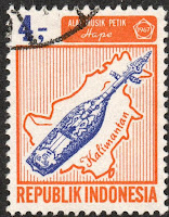
INDONESIA


INDONESIA.

Musical instruments.
Borneo (Kalimantan) Map and sape.
Eighth stamp in a set of 16, issued on 01.02.1967.
Face value: 4 Indonesian rupiah.
Printing: Photogravure.
Size: 25 x 32 mm.

Catalogs
- Michel No. 569.
- Scott No. 712.
- StampWorld No. 611.
- Stanley Gibbons No. 1147.
- Yvert et Tellier No. 505.
- Zonnebloem No. 570.

Borneo (Indonesian: Kalimantan) is the third largest island in the world and the largest in Asia. At the geographic center of maritime Southeast Asia, relative to the main Indonesian islands, it lies north of Java, west of Sulawesi, and east of Sumatra. The island is politically divided between three countries: Malaysia and Brunei in the north and Indonesia in the south.
The Indonesian portion occupies 73% of the island, it is officially called Kalimantan and is administratively divided into five provinces: Kalimantan Barat, Kalimantan Tengah, Kalimantan Selatan, Kalimantan Timur and Kalimantan Utara. Its population, in 2019, was 16,379,977 inhabitants. It has coasts on the Java and Celebes Seas and on the Macassar Strait, which separates Borneo from Sulawesi.

The sape (sapeh or hape) is a traditional lute of the communities who live on the banks of the rivers of East Kalimantan. Sapes are carved from a single bole of wood, and many modern instruments reaching over a metre in length. Initially the sape was a fairly limited instrument with two strings and only three frets. Its use was restricted to a form of ritualistic music to induce trance. Gradually the sape became a social instrument to accompany dances or as a form of entertainment. Today, three, four or five-string instruments are used, with a range of more than three octaves.